Foundation for
Middle East Peace
Twitter
Facebook
Email Sign-Up
Keyword
Search
About
Our Founder
Our Mission
Investment Policy
Grants
Our Grant Philosophy
Research
Legislative Round-Ups
Top News from Israel & Palestine
Lawfare
Settlement Reports
All Resources
Spotlight Issues
Targeting Palestinian Civil Society
Recognition of Palestine & Trump’s Peace Plan
IHRA // Redefining Antisemitism to Quash Criticism of Israel
Lawfare
Podcasts & Webinars
Index – Podcasts & Webinars (2022 and earlier)
Index – Podcasts & Webinars (2023-present)
Media & Subscribe
Media Mentions
Op-Eds
Subscribe
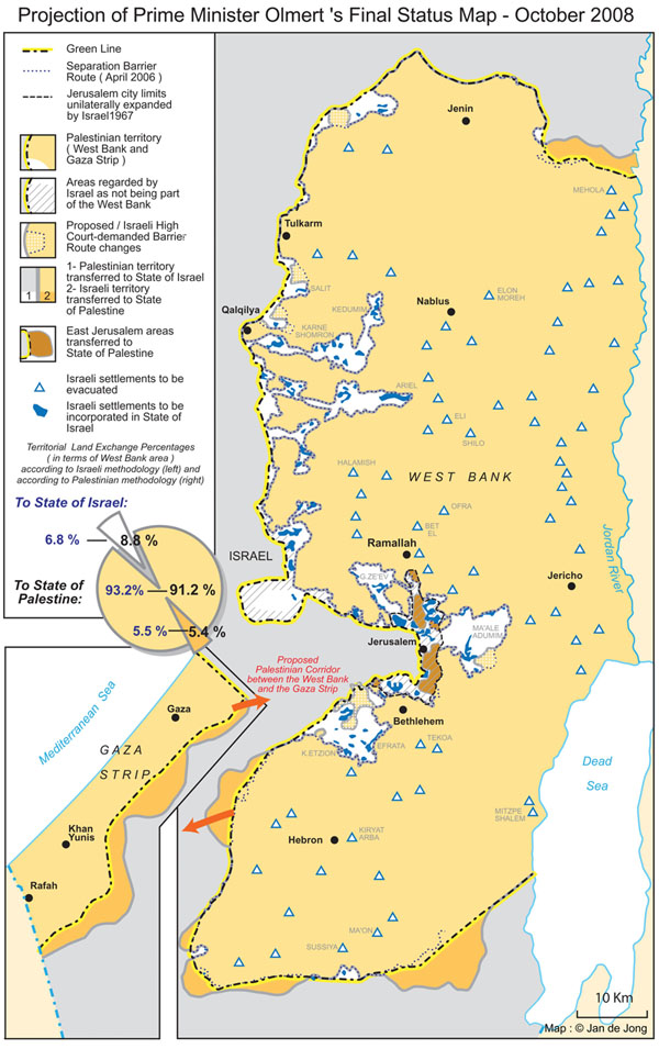
Olmert’s Final Status Map, West Bank & Gaza
Resource
November 13, 2008
Twitter
Facebook
Email